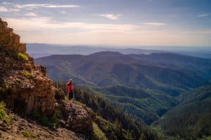
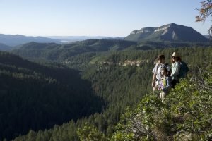
La Plata Canyon is in an area west of Durango (on the way to Cortez) with many options. We suggest starting out early as it often rains in the afternoon. There are a series of trails and a guide map to tell you were to go to hike through beautiful alpine flowers, columbine, and orchids to a nice alpine lake. This is an ideal spot for your picnic as long as its not too late in the afternoon as afternoon thunderstorms are frequent. This could be an all-day event, so bring a lunch, water, a jacket. In the winter, LPC is great for fat biking. From the main parking area, you can hike toward the left and find an old abandoned mine. If you go right, you will cross a creek and follow along to see an old mining cabin, and other mining remnants. If you don’t turn off of La Plata Canyon road, eventually you will come to Kennebec Pass. However, most people and most cars cannot just drive up to Kennebec pass because it is an unimproved road that usually requires the use of a high clearance 4×4. So another option is to go as far as your car will allow, and hike or bike to the pass.
Go west on Highway 160 about 10 miles from Durango. You will be in the town of Hesperus. Before you hit the Hesperus Ski Hill, make a right hand turn on to La Plata Canyon Road at the Kennebec Cafe. Drive on this road for 6-14 miles. There will be dirt roads along the way that were old mining roads and you can explore any of these. There will be an obvious spot when the road comes out of a canyon, and there is another road that branches off that is not nearly as wide or traveled that leads to a bridge.
Join us for a weekday trailwork party at [location TBD]. Thank you for volunteering with Trails 2000 at our trailwork party on Thursday, September 12 from 4:30 to 7:30pm!
Help protect natural areas and habitats by staying on established trails. Creating "social trails", cutting switchbacks, or ignoring trail closures leads to greater erosion and impacts on ecosystems.
Uphill traffic always has the right of way. Downhill traffic must be in control, especially around blind corners, to avoid coming in contact with uphill traffic.
Single track along river trail in La Plata Canyon dry and good to go. The single track now extends to La Plata City.
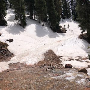
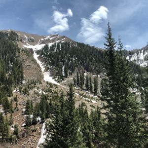
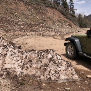
The road is dry all the way past Columbus. Any debris right past chimney has melted enough where you can drive by. Once you get closer to creek crossing there are still snow patches. Not rideable (or driveable) past creek crossing. Still lots of snow.