


High Point
Durango to TH
5 Miles
Gain
1500 Feet
Condition
Fair
Region
Trail Length
7 Miles
High Point on the Colorado Trail
The High Point on the Colorado Trail is 10 miles from the Colorado Trail trailhead, it doesn’t not have a sign but is a local’s favorite hang out. THere’s a log where many stop for a snack and a view before either making their way all the way up to Junction Creek Road (Champion Venture), the top of Segment 28 or turn around and head back down to the lower Colorado Trailhead.
The lower Colorado Trail is quite busy, we recommend mountain bikers exit the CT at the upper CT parking lot, located approximately one mile from the main trailhead. Many dogs are off leash.
Directions to lower Junction Creek Colorado Trail Trailhead
From downtown Durango, drive north on Main Ave. (US-550) and turn left on 25th St. This turns into Junction Creek Road/County Road 204. In 2.9 miles, the road forks. Stay left. In half a mile, you’ll see the Junction Creek Trailhead and carpark on your left.
To mountain bike to High Point
Start at the lower Colorado Trail trailhead at Junction Creek. Head up the CT to Gudy’s Rest, continue on the trail until you come to a trailhead sign that reads Colorado Trail Durango/Denver and another sign that reads Hofheins.
(To avoid the steepest part of the climb to High Point, detour down Hofheins, and then climb up Dry Fork to rejoin the Colorado Trail).
Total out and back is 28 miles. The detour adds about 2 additional miles.
Start at Dry Fork parking lot
Travel to Dry Fork Loop Trailhead
Start measuring from the US 550/160 intersection in Durango. Travel 3.3 miles on US 160 West and turn right on Lightner Creek Road, La Plata County Road 207. At 4.3 miles, turn right onto Dry Fork Road, CR 208, a graded dirt road suitable for all vehicles. Take the right fork at 6.3 miles. At 7.1 miles, a sign for Hofheins Connection Trail directs left into a large dirt lot.
Distance and Elevation
Dry Fork Loop is 9.1 miles, 1,500 feet of elevation gain; High Point spur adds 7.0 miles round trip
Map & Directions
Map Coordinates: 37.38682349537528, -107.96064301516171
Where's the Trailhead?
dIRECTIONS TO TRAILHEAD
Lower Junction Creek Colorado Trail Trailhead
From downtown Durango, drive north on Main Ave. (US-550) and turn left on 25th St. This turns into Junction Creek Road/County Road 204. In 2.9 miles, the road forks. Stay left. In half a mile, you’ll see the Junction Creek Trailhead and carpark on your left.
Travel to Dry Fork Loop Trailhead
Start measuring from the US 550/160 intersection in Durango. Travel 3.3 miles on US 160 West and turn right on Lightner Creek Road, La Plata County Road 207. At 4.3 miles, turn right onto Dry Fork Road, CR 208, a graded dirt road suitable for all vehicles. Take the right fork at 6.3 miles. At 7.1 miles, a sign for Hofheins Connection Trail directs left into a large dirt lot.
Trailwork
help build our trails!
Thursday, September 12 Trailwork
Join us for a weekday trailwork party at [location TBD]. Thank you for volunteering with Trails 2000 at our trailwork party on Thursday, September 12 from 4:30 to 7:30pm!
Trip Reports and Recent Photos
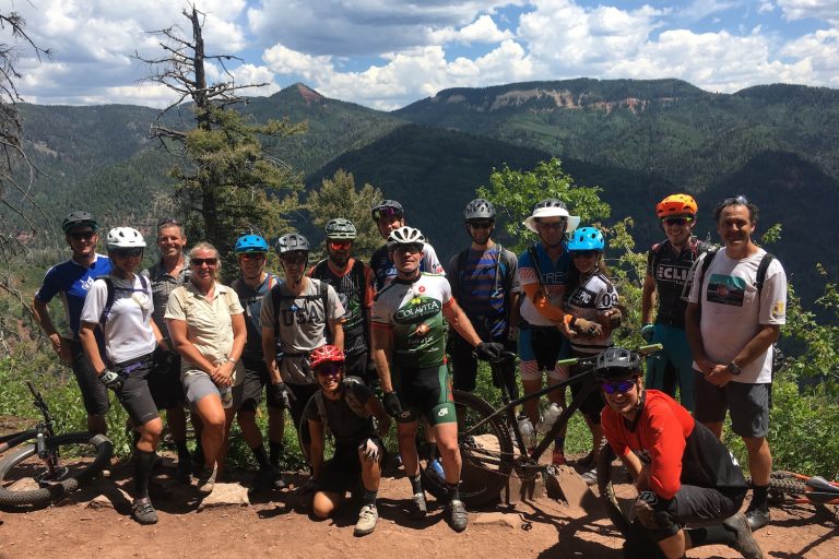
High Point
Submitted by: Patti Rosenthal
Date Visited:
5/16/21
Trail Condition:
Good
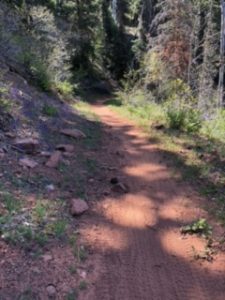
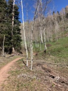
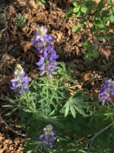
Comments:
Ride up to High Point dry all the way except for 2 puddles. The Lupine, Larkspur & Buttercups blooming on Dry Fork. On your up your up to High Point notice all the downed tree our sawyers have cleared – thank you Durango Trail Crew!
