


Dry Fork Trail
Durango to TH
9 Miles
Gain
1330 Feet
Condition
Fair
Region
Trail Length
3.9 Miles
Part of the Lower Colorado Trail system.
Popular among mountain bikers, trail runners, hikers and horseback riders, Dry Fork Loop is a popular singletrack trail that starts at the cattle guard on the west side of the Junction Creek Trailhead parking area. Climb about 1 mile to a split and turn left. The next 3-4 miles is a pleasant climb through pine, scrub oak and eventually, stands of aspen.
At the top of the climb turn right onto the Colorado Trail and climb a bit more. This 3-4 mile section is rolling, then mostly downhill until it reaches the junction with Hofheins Connection. Take a right on Hoffheins and mostly descend for several miles until a creek crossing and a short climb. You will soon come upon your first trail junction; take a left here and descend back down to the parking area and the start of the route.
Map & Directions
Map Coordinates: 37.34691, -107.937977
Where's the Trailhead?
dIRECTIONS TO TRAILHEAD
Dry Fork Parking
From downtown Durango, take US Hwy 160 west. Turn right on Lightner Creek Road (CR 207) and follow State Wildlife area (CR 208). Take one more right at the split toward Silver Mountain Ranch and a final left at the split away from Silver Mountain Ranch. This parking area is the start of the Dry Fork Loop.
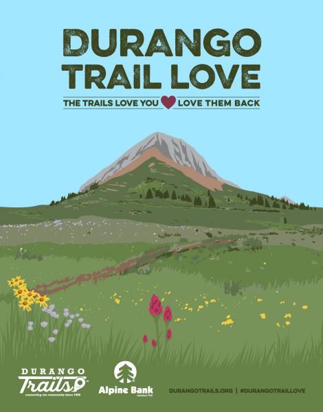
Love the Trails Like a Local
Say Hi
Greet all trail users by saying hi when passing on the trail.
Announce Yourself
Say "on your left" as approaching other trail users from behind.
Pick Up After Yourself
Pick up after yourself and your pet. Please don’t litter.
Keep Dogs on a Leash
Keep your dogs on a leash or leave them at home. Off-leash dogs are not allowed on City Open Space and are the number one source of trail conflict.
Stay on the Trail
Help protect natural areas and habitats by staying on established trails. Creating "social trails", cutting switchbacks, or ignoring trail closures leads to greater erosion and impacts on ecosystems.
Give Uphill Traffic the
Right of Way
Uphill traffic always has the right of way. Downhill traffic must be in control, especially around blind corners, to avoid coming in contact with uphill traffic.
Check Conditions
Stay up to date by checking the Trail Conditions report and following us on Facebook or Instagram.
Give Back
Donate to Durango Trails or volunteer for trailwork to help give back to the trails you love.
Trip Reports and Recent Photos
Dry Fork Trail
Submitted by: BK
Date Visited:
6/15/21
Trail Condition:
Good
Comments:
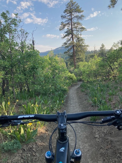
The trail is in great condition, both up and down. Everything is clear and smooth riding!
Dry Fork/CT Trail
Submitted by: Trail Reporter Pate
Date Visited:
5/2/21
Trail Condition:
Good
Comments:
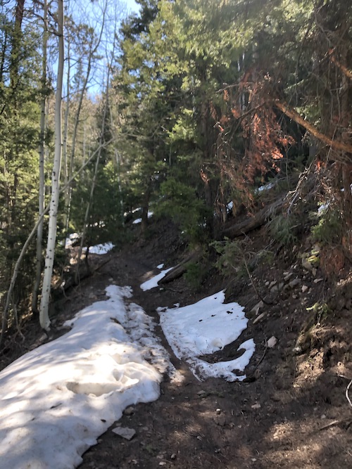
Dry Fork is “dry”! Dry Fork / Hoffheins loop good to go and clear of any downed trees. High point still not rideable. Shortly after second rock section snow and mud (way before red dirt). Love riding through the trees … feels like high-country riding but close to town.
