

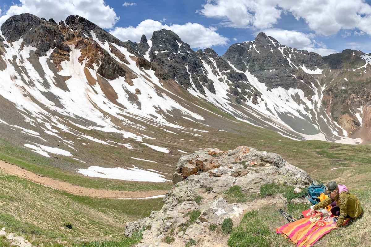
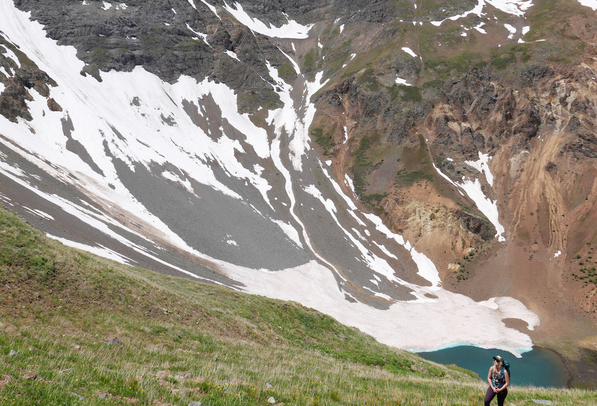
Velocity Basin
Durango to TH
57 Miles
Gain
1910 Feet
Condition
Poor
Region
Trail Length
1 Miles
Photo courtesy of Dan Brown
Part of Silverton Area Trails.
Velocity Basin is a cirque basin with a small turquoise lake at its base. Located at an elevation of 3.449m (11,315ft) above sea level, it is accessed from CR 52 outside of Silverton.
The road to the hike is a rocky 4×4 road and the hike is very steep and difficult to navigate. The hike involves climbing a steep grassy route to the ridge line and peaks that surround the lake. The trailhead starts at 11,327 ft and climbs 1,910 ft to the peak at 13,060. The trail is unmarked and difficult way finding.
You can also access from Boulder Gulch.
Map & Directions
Map Coordinates: 37.877024, -107.642446
Where's the Trailhead?
dIRECTIONS TO TRAILHEAD
CR 52 in Silverton
From downtown Durango, head north on Hwy 550 for 47 miles to Silverton. In Silverton, stay straight on Hwy 110/Greene St through town, then turn left to stay on Hwy 110 for approximately 6 miles. Take a right onto County Road 52, and follow for approximately 1.5 miles until the road dead-ends.
Trailwork
help build our trails!
Thursday, September 12 Trailwork
Join us for a weekday trailwork party at [location TBD]. Thank you for volunteering with Trails 2000 at our trailwork party on Thursday, September 12 from 4:30 to 7:30pm!
Love the Trails Like a Local
Say Hi
Greet all trail users by saying hi when passing on the trail.
Announce Yourself
Say "on your left" as approaching other trail users from behind.
Pick Up After Yourself
Pick up after yourself and your pet. Please don’t litter.
Keep Dogs on a Leash
Keep your dogs on a leash or leave them at home. Off-leash dogs are not allowed on City Open Space and are the number one source of trail conflict.
Stay on the Trail
Help protect natural areas and habitats by staying on established trails. Creating "social trails", cutting switchbacks, or ignoring trail closures leads to greater erosion and impacts on ecosystems.
Give Uphill Traffic the
Right of Way
Uphill traffic always has the right of way. Downhill traffic must be in control, especially around blind corners, to avoid coming in contact with uphill traffic.
Check Conditions
Stay up to date by checking the Trail Conditions report and following us on Facebook or Instagram.
Give Back
Donate to Durango Trails or volunteer for trailwork to help give back to the trails you love.
Trip Reports and Recent Photos
Velocity Basin
Date Visited:
June 2020
Submitted by: Dan Brown
