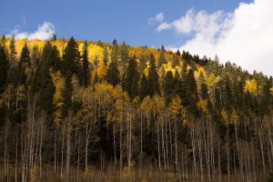
Silverton, Colorado offers a variety of moderate to difficult high country trails. Featured trails in the area include Rainbow Trail, Kendall Mountain, Stony Peak, Kendall Peak, Highland Mary Lakes, Columbine Lake and Pass, Ice Lakes, Porphyry Basin, Bear Creek National Recreation Trail, and Spencer Basin. For more information on Silverton area trails, click here.
From Molas Pass, head north on the Colorado Trail towards Cement Creek and into the town of Silverton. Or, explore the areas jeep roads from Pole Creek to Animas Forks. Hike the area fourteeners or thirteeners. Although Colorado is best-known for its “fourteeners”—mountains over 14,000 feet in elevation—the “thirteeners” in the area also present plenty of climbing challenges. Near Silverton you’ll find a number of thirteeners that can be completed as day hikes, including Kendall Mountain, Kendall Peak and Stony Peak.
For more information on the Columbine Lake Trail hike, click here.
From Durango, head north on Highway 550 for approximately 48 miles. This route will go past Purgatory Resort, Coalbank and Molas Passes. The Silverton area has a variety of moderate and technical trails in and around the town.
Join us for a weekday trailwork party at [location TBD]. Thank you for volunteering with Trails 2000 at our trailwork party on Thursday, September 12 from 4:30 to 7:30pm!
Help protect natural areas and habitats by staying on established trails. Creating "social trails", cutting switchbacks, or ignoring trail closures leads to greater erosion and impacts on ecosystems.
Uphill traffic always has the right of way. Downhill traffic must be in control, especially around blind corners, to avoid coming in contact with uphill traffic.