fbpx
taxonomy.php

Spud Lake Trail Hiking

Region:
Condition: Poor
Difficulty:
Trail Length: 2 miles
Distance from Durango: 32 miles
Gain: 540 ft
0 Loves

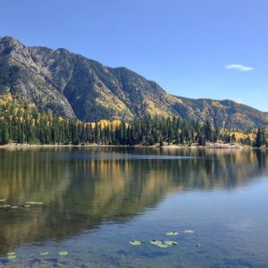
Spud Lake a short and sweet family friendly high country trail open to hiking which ends at Spud Lake.


La Plata Canyon BikingHikingTrail RunningWinter Recreation

Missy-Thompson-La-Plata-Canyon-Climb-Mountain-Bike
Region:
Condition: Good
Difficulty:
Trail Length: 9.3 miles
Distance from Durango: 18 miles
Gain: 2800 ft
0 Loves

La Plata Canyon trail is a long sustained climb up the La Plata Canyon Road to the Colorado Trail at Kennebec Pass.


Whitehead Trail HikingTrail Running

Region:
Condition: Poor
Difficulty:
Trail Length: 8.7 miles
Distance from Durango: 57 miles
Gain: 1950 ft
0 Loves

White Creek Trail is a difficult and scenic high country trail near Cunningham Gulch and Highland Mary Lakes trails.


Crater Lake Trail HikingTrail RunningWinter Recreation

Region:
Condition: Poor
Difficulty:
Trail Length: 5.4 miles
Distance from Durango: 41 miles
Gain: 1300 ft
0 Loves

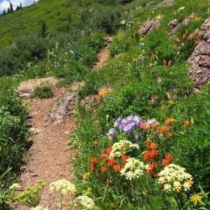
Crater Lake is a beautiful 5.4-mile one way trail near Andrew’s Lake, popular for day hikes in the high country.


Deer Creek Trail BikingHikingTrail Running

Colorado Pass Trail Wildflowers High Country Trails 2000
Region:
Condition: Poor
Difficulty:
Trail Length: 4.7 miles
Distance from Durango: 37 miles
Gain: 2100 ft
0 Loves

Deer Creek trail is a difficult, 4.6-mile trail that climbs steadily to meet Coal Creek, then Engineer Mountain Trail.


Animas Overlook Trail BikingHikingTrail Running

Region:
Condition: Fair
Difficulty:
Trail Length: 2.9 miles
Distance from Durango: 6 miles
Gain: 1400 ft
0 Loves

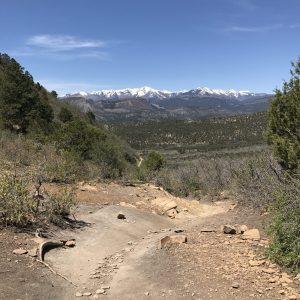
The Animas Overlook Trail is a difficult trail which begins/ends at the Animas Overlook and continues 3 miles to meet Log Chutes 1.


Log Chutes Downhill Biking

Log Chutes 2 Westview Trail Durango
Region:
Condition: Fair
Difficulty:
Trail Length: 1.7 miles
Distance from Durango: 6 miles
Gain: 1200 ft
0 Loves

Log Chutes Downhill trail is one of Durango’s only dedicated downhill trails.


Pautsky Point BikingHikingTrail Running

Telegraph View from the Top Horse Gulch
Region:
Condition: Poor
Difficulty:
Trail Length: 0.2 miles
Distance from Durango: 1.2 miles
Gain: 210 ft
0 Loves

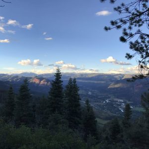
Pautsky Point is an optional trail extension at the top of Telegraph Trail with scenic views of Durango and the Animas Valley.


Milky Way Trail BikingHikingTrail RunningWinter Recreation

John-Geronimo-Raider-Ridge-Descent-Horse-Gulch
Region:
Condition: Poor
Difficulty:
Trail Length: 0.6 miles
Distance from Durango: 1.2 miles
Gain: 365 ft
0 Loves

Milky Way Trail is a difficult 0.6-mile trail which connects lower Horse Gulch trails to Raider Ridge.


EZ Trail BikingHikingTrail RunningWinter Recreation

John-Geronimo-Raider-Ridge-Descent-Horse-Gulch
Region:
Condition: Poor
Difficulty:
Trail Length: 0.3 miles
Distance from Durango: 1.2 miles
Gain: 70 ft
0 Loves

EZ is a difficult 0.3-mile trail that gains 70 feet as it climbs steadily to meet Rocky Road.


Support the trails that connect you to the outdoors

Trails are the cornerstone of our community and the gateway to the outdoors.

Help support our work so you can continue to connect to the outdoors by giving to Durango Trails!