fbpx
taxonomy.php

Deer Creek Trail BikingHikingTrail Running

Colorado Pass Trail Wildflowers High Country Trails 2000
Region:
Condition: Poor
Difficulty:
Trail Length: 4.7 miles
Distance from Durango: 37 miles
Gain: 2100 ft
0 Loves

Deer Creek trail is a difficult, 4.6-mile trail that climbs steadily to meet Coal Creek, then Engineer Mountain Trail.


East Fork Trail BikingHiking

Colorado Pass Trail Wildflowers High Country Trails 2000
Region:
Condition: Poor
Difficulty:
Trail Length: 6.6 miles
Distance from Durango: 29 miles
Gain: 1400 ft
0 Loves

Most commonly used as a mountain bike route, ride up Hermosa Park Road to East Fork onto Hwy 145, you can ride north up Hwy 145 to Scotch Creek and return to Hermosa.


Cunningham Gulch Hiking

Colorado Pass Trail Wildflowers High Country Trails 2000
Region:
Condition: Poor
Difficulty:
Trail Length: 1.8 miles
Distance from Durango: 57 miles
Gain: 1350 ft
0 Loves

Meeting with the Highland Mary Lakes connector, Cunningham Gulch bring you to unhindered views of Mount Rhonda, Kendall Peak, and Little Giant Peak before ending at the Colorado Trail.


West Lime Creek BikingHikingTrail Running

Region:
Condition: Poor
Difficulty:
Trail Length: 2.5 miles
Distance from Durango: 34 miles
Gain: 1100 ft
0 Loves

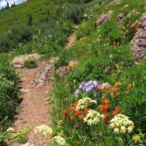
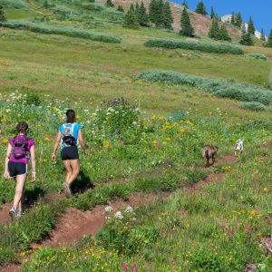
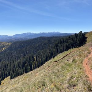
West Lime Creek Trail (FS #679) follows provides access to a variety of high-country trails, waterfalls, dispersed campsites and excellent views.


Engine Creek Trail BikingHikingTrail Running

Region:
Condition: Poor
Difficulty:
Trail Length: 3.4 miles
Distance from Durango: 40 miles
Gain: 1900 ft
0 Loves

Engine Creek Trail is part of a loop for mountain biking and hiking starting from the Molas Pass Campground.


Cascade Creek Trail BikingHikingTrail Running

Missy-Thompson-Cascade-Divide-Road-Engineer-View
Region:
Condition: Poor
Difficulty:
Trail Length: 8.1 miles
Distance from Durango: 29 miles
Gain: 835 ft
0 Loves

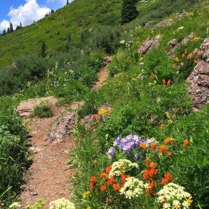
Cascade Creek follows along the western base of the mountain and often sees less traffic than other popular high-country trails in the area.


Pass Creek Trail BikingHikingTrail Running

Region:
Condition: Poor
Difficulty:
Trail Length: 2.7 miles
Distance from Durango: 34 miles
Gain: 1000 ft
0 Loves

Pass Trail is a great mountain bike ride or hike for most everyone, located near Engineer Mountain Trail.


Engineer Mountain Trail BikingHikingTrail Running

Region:
Condition: Poor
Difficulty:
Trail Length: 9.2 miles
Distance from Durango: 34 miles
Gain: 3600 ft
0 Loves

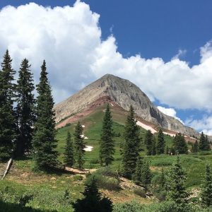
Engineer Mountain is a favorite hike or ride that is well marked and in close proximity to Durango, making it quite popular in the summertime.


Corral Draw Trail BikingHikingTrail Running

Region:
Condition: Poor
Difficulty:
Trail Length: 5.3 miles
Distance from Durango: 35 miles
Gain: 2500 ft
0 Loves

Corral Draw Trail connects the main Hermosa Creek trail to the Colorado Trail (at high country) near the northernmost part of the Hermosa Creek Trail.


Bolam Pass Road BikingHikingTrail Running

dutch-creek-hermosa-wildflowers-trails-2000
Region:
Condition: Closed
Difficulty:
Trail Length: miles
Distance from Durango: 35 miles
Gain: ft
0 Loves

Bolam Pass Road climbs 4 miles until the road levels out and connects to the Colorado Trail (at high country).


Support the trails that connect you to the outdoors

Trails are the cornerstone of our community and the gateway to the outdoors.

Help support our work so you can continue to connect to the outdoors by giving to Durango Trails!