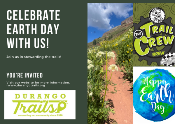
Earth Day is our trail season kick off, named as Durango Trails Day by the Governor and the 34th anniversary of our organization.
And you are invited to help us celebrate at the Trail Crew Brew Release Party. The event sponsored by Osprey and presented by Four Corners Community Bank takes place this Thursday, April 18 at Ska Brewing from 4p to 7pm. Please join us to celebrate the release of our cold fresh brew or pick up non alcoholic Skagua. People always ask what’s in the water in Durango and of course it’s our community, the trails and Ska!
Durango Trails mission includes creating community and we have been busy doing just that in April from working with our friends at the Durango Running Club; hosting Ambassador Training with our friends at SJMA and LPOSC, speaking at Seniors Outdoors and hosting trailwork with the FLC Environmental Center working on the LampPost trail.
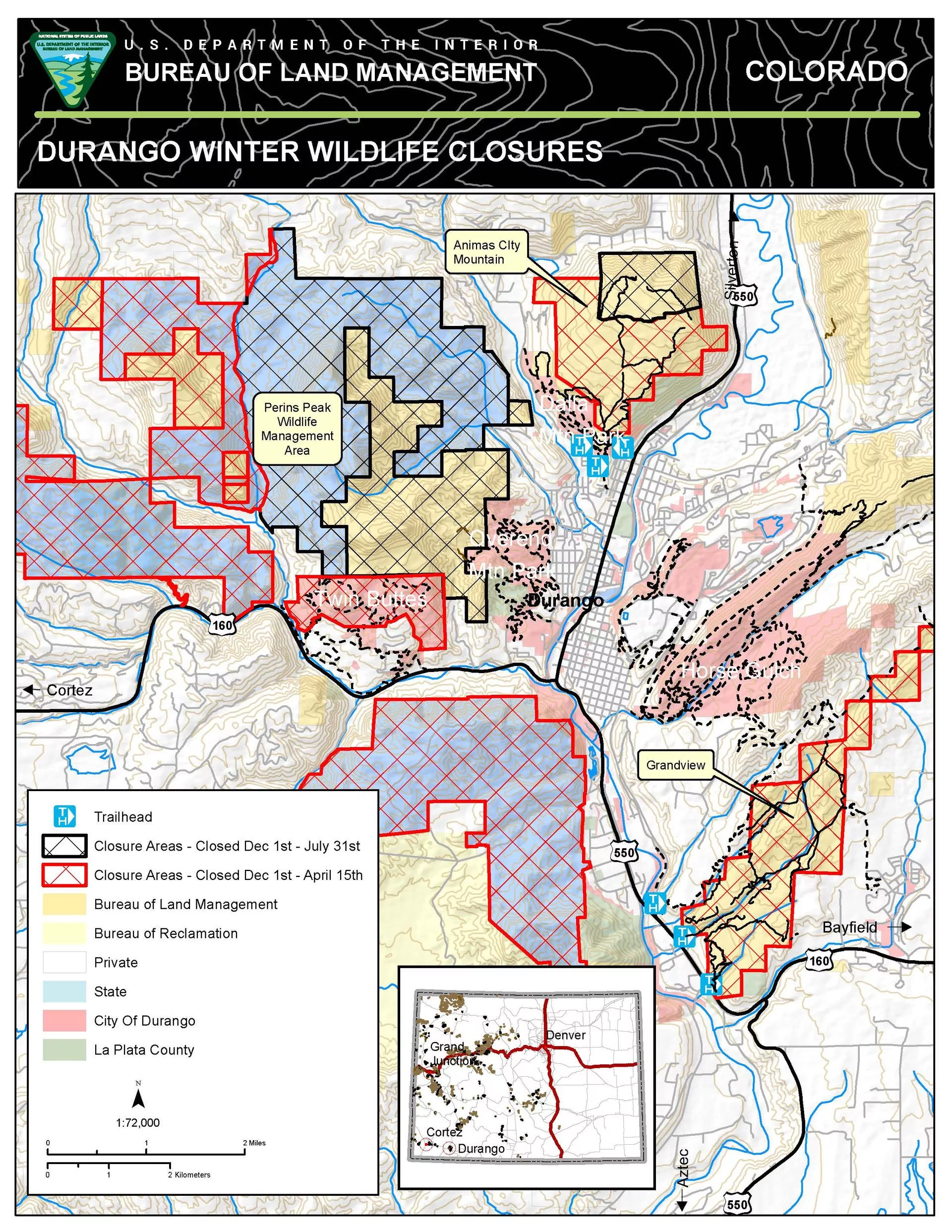
CPW Extends Seasonal Wildlife Closure on state lands
Colorado Parks and Wildlife will continue seasonal closures on state lands and the Bureau of Land Management will extend seasonal closures on Animas Mountain and Grandview Ridge through April 30 to protect vulnerable wildlife. Every year, the BLM coordinates with CPW to close these areas from Dec. 1 to April 15 to provide mule deer and elk with undisturbed wintering grounds, with the potential to reopen the areas up to two weeks earlier if conditions allow.Big Canyon, Sale Barn, and Threes Springs trailheads to Grandview will remain closed during this period, as will the upper loops on Animas Mntn.
Join Us at Durango Green Drinks
Next Thursday, April 25 5p-7pm
Sponsor Connect
TBK Bank proudly sponsors Durango Trails to support community wellness and environmental stewardship. By investing in trail maintenance and expansion, we’re fostering outdoor recreation, promoting physical and mental health, and enriching the fabric of our community. We encourage everyone to lace up their shoes, hop on their bikes, or simply take a stroll on these trails to experience the beauty of Durango firsthand. Together, let’s explore, connect, and thrive in the great outdoors!
Colorado Parks and Wildlife seasonal wildlife closures are December 1 through April 15, with possible extension to April 30 if conditions warrant:
Grandview Ridge
Big Canyon and Sale Barn trailheads (access located east of U.S. Highway 160)
South Rim Trail, portions of Sidewinder and Cowboy trails on BLM accessed from Carbon Junction Trail
Grandview BLM trails (access from Three Springs)
Animas City Mountain
BLM lands above the lower loops (approximately 1.5 miles above the 32nd Street trailhead).
Twin Buttes Area
All upper trails as marked.
Bodo State Wildlife Area
Exception: Smelter Mountain Trail is open from 10 a.m. to 2 p.m.; dogs are prohibited. Small game hunting is allowed in the area south of La Plata County Road 210.
In addition, the Perins Peak area east of County Road 208 and west of Hogsback is closed through July 31 to protect nesting peregrine falcons. Closures near Cortez include the Aqueduct, Chutes and Ladders, the Summit areas within the Montezuma Triangle Recreation Management Zone and portions of the Cortez Special Recreation Management Area.
The following Durango-area trails will remain open for hiking, biking, snowshoeing, and skiing:
Horse Gulch, Telegraph, Crites, and Skyline areas
Meadow, Stacy’s, Mike’s, Telegraph, Crite’s, and Sugar trails
All of the Raider Ridge Trail to Medicine
Ben’s Down and Out and Charmed trails
Carbon Junction trailhead at Highway 3 to Telegraph via Crites Connection are open.
Lower Twin Buttes trails
Access off of Highway 160 West; upper loops are closed.
All of Dalla Mountain Park
Access off of Junction Creek Road.
Lower Twin Buttes trails
Access off of Highway 160 West; upper loops are closed.
Overend Mountain Park
Access at Leyden Street, Montview Parkway, Crestview Drive, and Hidden Valley Circle.
Trails around Fort Lewis College and along the Rim
Lions Den, Chapman Flow, and Jump Line
Lower Twin Buttes trails
Access off of Highway 160 West; upper loops are closed.
The Rim, Squawker, Tawker, and Skyline trails (accessed from the Powerline Trail).
The Colorado Trail
Access at Junction Creek.
A 1.5-mile loop trail on the lower portion of Animas City Mountain
Access off of Highway 160 West; upper loops are closed.
Access from the Birket Drive and 32nd Street trailheads or Dalla Mountain Park.
Durango Trails “Trail Conditions Report” is updated for winter including areas open for cross country skiing, fat biking and other winter related conditions. Please be sure to check the CAIC website and know before you go.
Sepp Kuss Celebration Schedule of Events - Thursday, October 19, 2023
Parking is limited: all attendees are encouraged to ride their bikes to the event
3:30 p.m. – Speeches and Q&A at Buckley
4:30 p.m. – Bike Parade: South on Main Avenue to the train station, left, then left on East 2nd Avenue, and north on East 2nd Avenue back to Buckley Park.
5:15 p.m. – Post Parade Celebration/Autographs/Live Music
7:00 – Buckley Park Closed
303Endurango is going to try to broadcast the event on Facebook Live
Volunteers are needed as parade marshalls and park crowd management
Durango Devo’s Executive Director, Levi Kurlander, says, “Durango Devo is proud of all our alumni, and we’re certainly proud of Sepp Kuss! He is a great example of what makes Durango Devo and the Durango cycling community special. We are honored to host the Vuelta a España champion and Tour de France stage winner and celebrate his achievements in his hometown.”
Special thanks for this event is owed to these community partners: Durango Devo staff and sponsors; the City of Durango; Visit Durango and Spoketober; Verde PR; Ska Brewing; Durango Coca-Cola; the Iron Horse Bicycle Classic; Durango Trails; and Fort Lewis College Cycling.
ROADS CLOSED AT 3:00 PM:
Main Ave between 12th and 13th St.
13th Street by Buckley Park
ROADS CLOSED AT 4:15 PM:
Main Ave south from 12th St.
E 2nd Ave between 12th and 5th St
5th St & 12th Street between Main and 2nd.
Join us as we come together to celebrate Sepp Kuss’s remarkable achievements and the spirit of Durango’s cycling community.
Durango, Colorado -The City of Durango, the La Plata County Humane Society, Visit Durango, and Durango Trails are launching a Back to SchooP program to encourage area pet owners to pick up after their pet and remind them that City and County ordinances require dogs be on leash in Horse Gulch, Overend Mountain Park, Dalla Mountain and Animas Mountain.
“We notice a number of dogs off-leash that may leave trail users a present without the owners noticing or schooping the pile. Trailheads and sections of trails are littered with dog waste that affects our water, wildlife, other dogs and trail users,” according to Scott McClain, Interim Parks and Recreation Director with the City of Durango.
“Durango is a dog-loving place, and we also love our trails and open space. To prevent issues with trail users and wildlife, dogs must be leashed in our area open spaces and owners must pick up their dog’s waste,” said Clint Garrett, Animal Protection Supervisor with the La Plata County Humane Society. “Reports of unleashed dogs will be treated as a ‘dog at large’ under Durango City Ordinance 4-41 and the owner is subject to a citation, fine and court costs.”
The City of Durango website also states: “Pet waste bags and garbage receptacles are provided throughout our parks and trailheads. Be sure to carry extra bags and don’t forget to grab your filled bags on your way back to the trailhead if you’d set your bag by the side of the trail.”
Poop from pets can carry germs like bacteria and parasites that can make people and other pets sick, contaminate waterways, and harm the environment, per the Centers for Disease Control and Prevention.
Colorado is the poopiest “Dog Poop State,” according to research done by Protect My Paws. Do your part to make Durango the exception to this unfortunate trend. There is an off-leash dog park located 0.1 mile west of the intersection of Hwy. 160 West and Hwy. 550, on the south side of Hwy. 160 West.
Remember, don’t be a poop and get back to the schoop (and leash)!
About Durango Trails: Formed in 1990, as Trails 2000, the organization underwent a brand refresh to celebrate its 30th anniversary. The mission is to plan, build and maintain trails, educate trail users, and create connections. Durango Trails relies on community support for all of its projects. Volunteers contribute more than 4,000 hours of trailwork annually to Forest Service, BLM, County, City and private landowners. For more information, visit www.durangotrails.org and www.facebook.com/ durangotrails
The La Plata County Humane Society is committed to enhancing and protecting the lives of companion animals by ensuring the provision of sustenance, safety and shelter, educating the community regarding humane treatment of animals, and preventing pet overpopulation.
We’re thrilled to announce our annual spring Membership Party coming up on Friday, April 21, 2023 at Ska Brewing!
Hosted by our friends at Ska Brewing and sponsored by Osprey with supporting sponsor Four Corners Community Bank, we hope to see you and help us kick-off our trail season!
Please attend and Join or Renew your Membership and
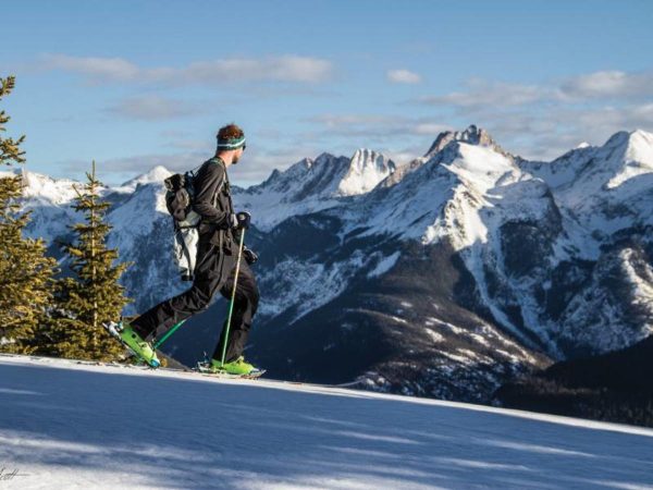
Durango is known for some of the best snowshoeing around. With an abundance of trails and millions of acres of open land and national forests, Durango is the perfect spot to get out for a hike this Winter.
In the winter months, many of the trails around Durango transform into perfect snowshoeing routes, allowing you to explore everything from leisurely, groomed walks to more challenging adventures to get your blood flowing. Snowshoeing is the perfect activity for those of all ages and skill levels regardless of experience.
Click here to read the full guide to snowshoeing in the Durango area, courtesy of Visit Durango.
2023 snow conditions provide various winter trail recreation options. Check out our updated Winter Trail Conditions Page and learn about the winter trail adventures.
Remember to learn about avalanche safety, and visit the CAIC (Colorado Avalanche Information Center) website which provides avalanche safety information, education and promotes research to help people reduce their risk from avalanches.
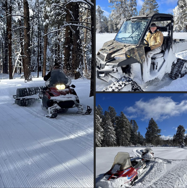
More Snow = Good News
Chicken Creek and Bauer Loops are groomed and open. Only XC or snowshoes allowed: they state walking on groomed trails not allowed.
Hillcrest opens Tuesday, Jan 3 for skate and classic. Please stay on groomed trails.
Vallecito groomed for skate and classic.
Boggy Draw groomed for fat biking.
Durango Nordic finally able to get the groomer out but they have a lot of snow so still a bit soft but looking great.
LaPlata Canyon and Junction Creek (FS 171) great for touring skis.
Video campaign highlights the importance of respecting seasonal wildlife closures in Durango – in effect Dec. 1, 2022.
Ever wonder why certain trails in Durango have seasonal wildlife closures? During the winter months, deer and elk need safe harbors and seasonal wildlife closures are essential for the animals to survive. Even when there is no snow on the ground these areas are critical for animals to make it through the winter. That’s why Durango Trails this week launched an informational and educational video campaign aimed at educating and inspiring users to follow certain etiquette and safety guidelines when traveling on trails in Durango and the surrounding area. The first video, “It’s Up To Me,” highlights the importance of abiding by the winter seasonal wildlife closures.
It’s up to me. It’s up to us. It’s up to all of us to protect wildlife in Colorado.
The seasonal wildlife closures go into effect Tuesday, Dec. 1, 2022, until April 15, 2023, on the following areas:
Grandview Ridge
Big Canyon and Sale Barn trailheads (access located east of U.S. Highway 160)
Grandview BLM trails
Animas City Mountain
BLM lands above the lower loops (about 1.5 miles above the 32nd Street Trailhead)
Twin Buttes Area
The upper trails only, as marked.
Bodo State Wildlife Areas
This area is closed with the exception of the Smelter Mountain Trail that is open from 10 a.m. to 2 p.m. Dogs are prohibited.
Perins Peak
Watch the video here or by clicking the video above. Visit our Trail Conditions Report for up to date trail conditions. You can also learn more about wildlife in Colorado by visiting the Colorado Parks and Wildlife website.
Campaign video made possible through Durango Trails receipt of the Partners in the Outdoors grant from the Colorado Parks and Recreation Association (CPRA) in partnership with Colorado Parks and Wildlife (CPW). The videos were produced by Coldstream Creative and include local talent.
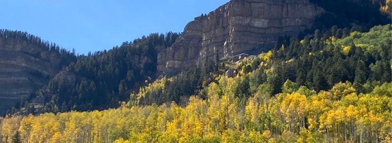
Fall is the perfect time to hit the trails. Flowing along to the sound of golden aspen leaves under your tires or shoe tread; being outdoors rarely feels so good. There are notes of summer and hints of winter, and nothing beats being outdoors surrounded by the golden, red, yellow and green hues.
Durango Trails recommends several special places to best experience this pumpkin-spiced time of year:
Animas Mountain Start at the trailhead on 4th Avenue, and take this 6 mile round-trip hike through the forest and up the mountain for a great view of the valley. The mountain bike, trail running and hiking trails provide a stout climb to the top, where the view from Animas Mountain into the Falls Creek Valley provides a great vista of fall colors.
Missionary Ridge While a popular hunting area (make sure you’re decked out in blaze orange), Missionary and Steven’s Creeks embrace you with the beauty of fall. Plenty of trees abound, whether on Red or First Fork, and will tantalize leaf peepers with abundant fall colors. Check this link for more info.
Hermosa Creek Trail While the 416 fire left its mark in the Hermosa area, the remaining trees and oak brush still provide beautiful views of fall colors along Hermosa Creek. Start with an out-and-back from lower Hermosa, or drive up to Purgatory and enter from upper Hermosa Park Road. You may encounter standing water along the way. On your way up, you can also take a detour to the Cutthroat Trail at the intersection of Relay Creek and Cascade Divide Road.
West Cross Creek Many a local’s favorite ride is the climb up Hotel Draw Road combined with the descent down West Creek Trail back to the Upper Hermosa parking lot. The trail is a windy single track with incredible views across the aspen-covered valley.