Twin Buttes Trail System
Biking, Hiking, Trail Running, Winter Recreation
Durango to TH
2.5 Miles
Gain
700 Feet
Condition
Good
Region
Trail Length
12 Miles
Twin Buttes Trail System has moderate steady climbs, tight banked turns and classic single track. While a popular mountain bike location, it is also a multi-use trail. It is located off Hwy 160 in Durango. There is a dirt parking lot near a gas station on the North side of the road. The main (East) trailhead is here and the second access trail is on Lightner Creek Road (CR 207) which will lead you east towards the main entry.
Featured trails: Ed and Flo for their twisty and whoopy turns.
Map & Directions
Map Coordinates: 37.269060, -107.913794
Where's the Trailhead?
dIRECTIONS TO TRAILHEAD
Twin Buttes Trailhead Parking
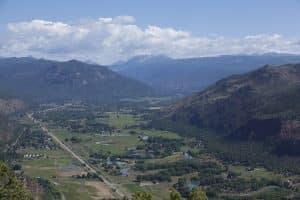
From Durango, go west on Highway 160. After approximately 1.5 miles you’ll see a dirt parking lot near the Speedway gas station on the North side of the road. Turn right into the trailhead parking lot. You can also continue on Hwy 160 to the second access trail which is on Lightner Creek Road (CR 207).
Trailwork
help build our trails!
National Trails Day | Durango Trailwork at Dry Fork Trail
Celebrate National Trails Day by joining us for trailwork at Dry Fork Trail on June 3rd from 9am to 1pm. Lunch will be provided at the trailhead afterwards. Please note, registration is required to join us for trailwork; please click below to register.