Colorado Trail System (Lower)
Durango to TH
5 Miles
Gain
1015 Feet
Condition
Fair
Region
Trail Length
4 Miles
Trails in this system
The iconic Colorado Trail stretches 500 miles from Denver to its terminus in Durango and is one of the state’s great recreational assets. The trail travels at high elevations through the spectacular Rocky Mountains and traverses craggy peaks, alpine lakes and creeks amongst diverse ecosystems.The trail’s thru travelers experience six wilderness areas, pass through eight mountain ranges and top out 13,271 feet, just above Coney Summit.
The average elevation of the Colorado Trail is over 10,300 feet and users traveling from Denver to Durango will clock 89,354 feet of elevation gain. The trail ends only a short three miles from Durango city limits, allowing easy access from town. For more information about the upper-elevation trails, see Colorado Trail (High Country).
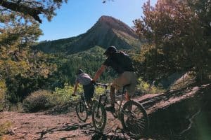
Maintenance of Colorado’s premier long distance trail is undertaken by teams of volunteers who caretake sections. Durango Trails 2000 adopts the longest section in the state – a rugged singletrack from Champion Venture Road (near Kennebec Pass) to the town of Durango.
Colorado Trail at Junction Creek
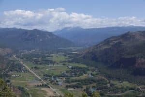
The Colorado Trail at Junction Creek is one of the best trails in the Durango area, great for both hiking and biking, and perfect for most skill levels. The trail is lovely in all seasons, with access to picturesque Junction Creek and its shallow pools in the summer; surrounding canopies of golden leaves in the fall; and snowshoeing and fat biking in the winter.
From the trailhead, you’ll start out on a nice, flat trail that follows Junction Creek. When you reach the bridge, you will have gone about 2.5 miles (if you are a beginner, the bridge is a good goal). After this, the trail begins some steep switchbacks and eventually winds its way up to Gudy’s Rest, which has a sitting spot and nice view of Durango.
Colorado Trail from High Point to Gudy’s
After Gudy’s Rest (along the Colorado Trail), you can turn left to head down Hoffheins and loop back around from Dry Fork, back to the Colorado Trail. Or continue straight and make it to High Point and come on back down. A roundtrip ride to High Point on a bike is 4-5 hours. Gudy’s Rest can be accessed from the Junction Creek Trailhead or Dry Fork.
Map & Directions
Map Coordinates: 37.331377, -107.902912
Where's the Trailhead?
dIRECTIONS TO TRAILHEAD
To access the Junction Creek Trailhead from downtown Durango, head north on Highway 550 (Main Avenue). Take a left hand turn at 25th Street (by the Exxon). The road will wind through a subdivision, becoming CR 204 (Junction Creek Road). At a three-way intersection, stay straight on CR 204, and follow this until you come upon a dirt parking lot and trailhead on your left.
If this parking area is full, continue along the dirt road for 1 mile to a secondary dirt parking area near an intersection with the Lower Colorado Trail.
Trailwork
help build our trails!
Thursday, September 12 Trailwork
Join us for a weekday trailwork party at [location TBD]. Thank you for volunteering with Trails 2000 at our trailwork party on Thursday, September 12 from 4:30 to 7:30pm!
Love the Trails Like a Local
Say Hi
Greet all trail users by saying hi when passing on the trail.
Announce Yourself
Say "on your left" as approaching other trail users from behind.
Pick Up After Yourself
Pick up after yourself and your pet. Please don’t litter.
Keep Dogs on a Leash
Keep your dogs on a leash or leave them at home. Off-leash dogs are not allowed on City Open Space and are the number one source of trail conflict.
Stay on the Trail
Help protect natural areas and habitats by staying on established trails. Creating "social trails", cutting switchbacks, or ignoring trail closures leads to greater erosion and impacts on ecosystems.
Give Uphill Traffic the
Right of Way
Uphill traffic always has the right of way. Downhill traffic must be in control, especially around blind corners, to avoid coming in contact with uphill traffic.
Check Conditions
Stay up to date by checking the Trail Conditions report and following us on Facebook or Instagram.
Give Back
Donate to Durango Trails or volunteer for trailwork to help give back to the trails you love.